Executive Summary
Summary of high level findings in this report.
The Alberta Biodiversity Monitoring Institute (ABMI) measures and reports on the state of biodiversity and human footprint across Alberta. This report is the five-year update on the status of land cover and biodiversity in the Alberta Pacific Forest Industries Inc. (Al-Pac) Forest Management Agreement (FMA) area. Building on the first biodiversity status report released in 2009, and the update released in 2015, the Al-Pac FMA area is the first administrative unit in the province to have available a series of five-year status updates for land cover and biodiversity.
The Al-Pac FMA area has been certified by the Forest Stewardship Council® (FSC®) since 2005 and is the largest FSC-certified forest in the world. Throughout this report, applicable FSC Indicators that can be addressed by ABMI data are highlighted to support Al-Pac's conformance to the FSC standards.
Area of Analysis
There are two areas of assessment included in this report—the Al-Pac FMA area and the Area of Ecological Interest (AEI).
The Al-Pac FMA area:
- makes up 10% of Alberta’s land area;
- is predominantly forested with fire as the principal natural disturbance;
- includes wetland ecosystems that cover about 40% of the area;
- overlaps with five natural subregions including: Central Mixedwood, Lower Boreal Highlands, Upper Boreal Highlands, Athabasca Plain, and Lower Foothills
The AEI, which is almost double the size the FMA area, is an ecologically-based analysis unit that is applicable to various FSC criteria and indicators.
Methods
The ABMI has collected monitoring data at 154 of 157 permanent sites in the Al-Pac FMA area, and 323 out of 355 sites in the AEI. At each location, ABMI technicians recorded the species present, and measured a variety of habitat characteristics.
The ABMI also measured human footprint using fine-resolution aerial photography and satellite imagery at two spatial scales. Detailed assessment of human footprint was completed using a 3 × 7 km area around each of the 157 permanent monitoring sites between 1999 and 2017. A broad assessment of human footprint was also conducted using a wall-to-wall human footprint map for the entire province circa 2017. Land cover and species data were used to assess the status of a number of indicators.

Human Footprint & Land Cover Results
Status & Trend in Human Footprint
As of 2017, the total human footprint across the Al-Pac FMA area was 8.5%.
- Covering 5.5% of the Al-Pac FMA area, forest harvest was the largest human footprint.
- When recovery of harvested areas is considered, effective forestry footprint equals 4.0%.
- Energy footprint covered 2.1% of the Al-Pac FMA area.
- Transportation footprint, urban/industrial footprint, and human-created waterbodies each covered less than 1% of the region.
The total amount of human footprint in the Al-Pac FMA area increased by 4.8 percentage points between 1999 and 2017, from 3.7% to 8.5%.
- This increase was largely driven by forestry footprint, which grew by 3.5 percentage points, from 2.0% to 5.5%.
- Energy footprint increased by almost 1 percentage point during this period, increasing from 1.2% to 2.1%.
Linear Footprint
As of 2017, density of linear features in the Al-Pac FMA area was 3.17 km/km2. The predominant line types include seismic lines (2.17 km/km2), followed by pipelines (0.25 km/km2), and roads (0.15 km/km2).

Trend in Vegetation Types
36% of the Al-Pac FMA area is composed of stand types suitable for forestry, including deciduous and mixedwood forest, which cover 19% and 5% of the FMA area, respectively. Trends by stand type from 1999 to 2017 show:
- Deciduous stands decreased by 2.3 percentage points from 18.4% to 16.3%;
- Old deciduous stands increased by 2.0 percentage points from 4.8% to 6.9%;
- Mixedwood stands decreased by 0.9 percentage points from 4.8% to 3.9%;
- Old mixedwood stands decreased by 0.3 percentage points from 2.0% to 1.7%.

Interior Native Habitat
As of 2017, 91.5% of the Al-Pac FMA area has no direct human footprint. However, 23.8% of native vegetation in the FMA area is greater than 500 m from human footprint.

Research Spotlight
Spectral regeneration is a method to assess the spectral recovery of harvest areas by measuring wavelengths of light reflecting from the ground surface. Several metrics were used to assess the spectral recovery of harvest areas in the Al-Pac FMA area. Preliminary results are presented.
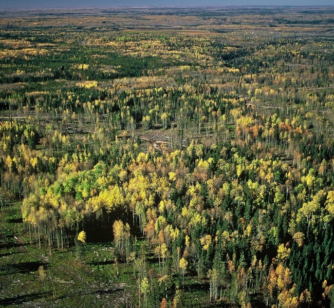
Photo: Al-Pac
Status of Biodiversity
Biodiversity Intactness
The ABMI assessed the status (current condition) of 684 species in the Al-Pac FMA area and found the Biodiversity Intactness Index to be, on average, 94.6% in 2016.
Of the full suite of species assessed by the ABMI in the Al-Pac FMA area, we profile species associated with old deciduous and mixedwood forests within birds, mites, vascular plants, mosses, and lichen because Al-Pac forestry activities disproportionately affect deciduous and mixedwood forest. Results for all mammal species are also shown.
Intactness for these species was found to be:


Sector Effects
At the local-footprint scale, the vast majority of species associated with old deciduous and mixedwood forests are predicted to decrease in all footprint types compared to in the habitat each footprint replaces. However, predicted population changes at the regional scale are small because the area occupied by the different footprint types is small in the Al-Pac FMA area. Forestry footprint generally results in the largest predicted loss of suitable habitat for species associated with old forest because harvesting is the largest footprint type, and harvesting mostly occurs in old upland forest.
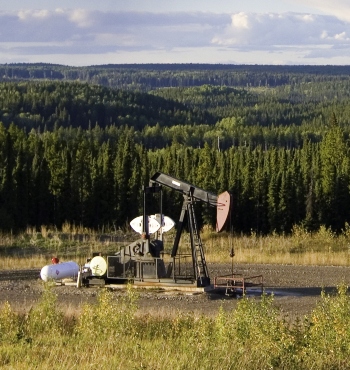
Photo: Jason Kasumovic
Additional Results
-
A total of 26 non-native vascular plant species were detected in the Al-Pac FMA area, including four noxious weeds: Creeping Thistle (detected at 4.3% of the sites surveyed), Perennial Sow-thistle (2.8%), Tall Buttercup (0.7%) and Scentless Chamomile (0.7%). Non-native species were detected at 39% of the sites surveyed. At sites where they were found, there was an average of 1.9 non-native species present.
- Al-Pac tracks 25 designated species-at-risk in the Al-Pac FMA area. Most of these species (73%) are birds and mammals that are provincially listed as sensitive.
- Al-Pac tracks 82 culturally important species. The status of habitat for 58 of these species is 92.5% (on average) as measured by the Biodiversity Intactness Index.
- The density (#/ha) of living trees and snags (standing dead trees) in the Al-Pac FMA area was similar between 2010 and 2016 based on changes in the landbase, with the exception of deciduous trees which had similar levels.
- The volume (m3/ha) of all downed woody material and large downed woody material was predicted to have increased slightly between 1999 and 2012.
This report describes the status of land cover and different components of biodiversity in the Al-Pac FMA area. This is the third report since the ABMI’s first status report on the area released in 2009. These findings can be used to evaluate the outcomes of responsible forest management in the Al-Pac FMA area.
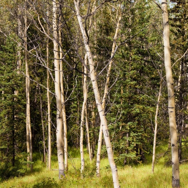
Photo: Stephan Pietzko