Section 1.2
Reporting Area & Landscape Context
Al-Pac FMA Areamakes up 10% of Alberta's land area.
This predominantly forested region includes a diversity of forest types and wetlands. In addition to forest harvesting, large areas of the Al-Pac FMA area are leased for oil and gas development.
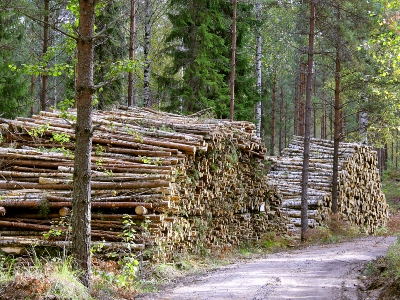
Forest harvesting is one of several land uses in the Al-pac FMA area.
Photo: ABMI
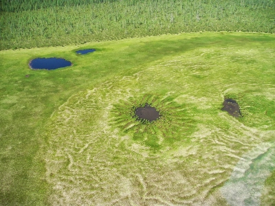
Wetland ecosystems cover about 40% of the Al-Pac FMA area.
Photo: ABMI
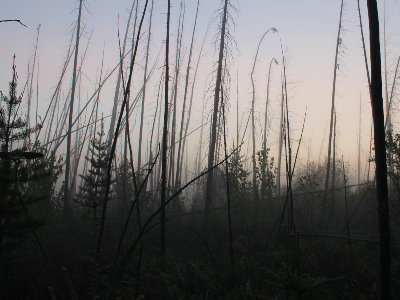
Fire is the principal natural disturbance in the boreal forest.
Photo: Caitlin Willier
Introduction
The Al-Pac FMA area covers approximately 63,700 km2 in the Boreal Forest Natural Region of northeastern Alberta. The region where Al-Pac’s FMA area is located includes[1]:
- a mosaic of upland forests composed mainly of Trembling Aspen, Balsam Poplar, White Spruce, White Birch, and Jack Pine, and lowland forests composed of Black Spruce and Larch;
- 1.9 million hectares of potentially harvestable* forest, mainly upland Trembling Aspen and White Spruce forest;
- 4.9 million hectares of wetlands, non-commercial black spruce stands and non-harvestable forest areas (river valleys, slopes, and riparian buffers);
- large areas leased for oil and gas development and its associated infrastructures, such as roads and utilities;
- socially and economically valued activities including hunting, fishing, trapping, and other recreational pursuits.
*The size of trees in a forest stand reflects a combination of time since last disturbance and the productivity of the site. Harvest age is reached by 60 to 80 years for deciduous species like Trembling Aspen and Balsam Poplar, and 80 to 100 years for conifer species.
Al-Pac primarily harvests deciduous trees (Trembling Aspen and Balsam Poplar) but also harvests small numbers of birch and conifer trees (White Spruce, Jack Pine and Black Spruce). Other forest companies (commonly referred to as quota holders) that operate in the FMA area harvest conifer species, predominantly White Spruce with some Black Spruce and Jack Pine. Between 1993 and 2019, Al-Pac and other forest companies harvested about 367,000 hectares, which represents 6% of the total FMA area and about 19% of the commercially productive forest.
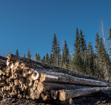
Al-Pac primarily harvests deciduous trees while quota holders harvest conifers.
Photo: Jesse Cruz, FSC® Canada - 2017
About the Al-Pac FMA Area
Click on a topic to find out more about the Al-Pac FMA area and surrounding region.
Area of Analysis
At the request of Al-Pac, this report covers two analysis areas:
Al-Pac FMA Area
-
The Al-Pac FMA area boundary has not changed significantly since the 2015 ABMI biodiversity report update.
-
Prior to 2015, portions of the FMA area were removed as a result of the treaty land entitlement process settled between the governments of Canada, Alberta and Bigstone Cree Nation.
-
Deletions and additions to the FMA boundary also occurred as a result of the Government of Alberta’s Lower Athabasca Regional Plan in 2012[1,2].
Area of Ecological Influence
- is a spatial area that is applicable to various FSC criteria and indicators (e.g. 6.1 and 6.5);
- is an ecologically-based analysis unit defined by all Ecodistricts[3] that overlap two FMA areas—Al-Pac and Mistik Management Ltd (Mistik) in Saskatchewan[4];
- extends across the Alberta-Saskatchewan border; the AEI in this status report only considers the area in Alberta.
References
Government of Alberta. 2012. Lower Athabasca Regional Plan. Available at: www.landuse.alberta.ca.
Alberta Pacific Forest Industries. 2012. Forest Stewardship Report Overview: Reporting Period 2006–2010. Available at: https://alpac.ca/application/files/3014/1876/0531/Overview_-_2011_Al-Pac_Forest_Stewardship_Report_v5_4_bb_-_dds_September_2012.pdf.
Anonymous. 2018. Introduction to the Ecological Land Classification (ELC) 2017. Statistics Canada. Ottawa, ON. https://www.statcan.gc.ca/eng/subjects/standard/environment/elc/2017-1.
DUC, CPAWS, Al-Pac, Mistik. 2018. Protected Areas Gap Analysis – Phase 1 Report, North East Alberta & North West Saskatchewan. 46 pp. Internal Report.
Arcese, P. and A.R.E. Sinclair. 1997. The role of protected areas as ecological baselines. Journal of Wildlife Management 61(3):587:605.
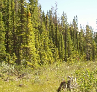
Spruce forest
Photo: ABMI